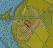
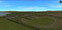
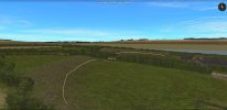
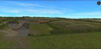
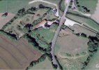
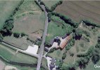
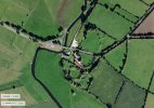
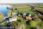
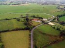
The 82nd Airborne's four-day battle to capture and secure the la Fiere manor, bridge and causeway never mentions that the manor was built on top of the site of an old medieval motte and bailey castle. Or perhaps a viking encampment, or perhaps something more ancient?. I have been unable to find the history of it. Yesterday i stumbled upon colour aerial photos online taken by a drone that clearly show the old earth ramparts from various angles. If one takes a ground view walkabout using google maps, down the hill towards the bridge from east to west and looks back up the hill then it is possible to catch glimpses of the rampart above the bocage, the sunken lane that was the ancient ditch, and loooking at the manoir - the single hump above the roof of the outbuildings. I have included screen shots of the work in progress to recreate that to give the reader an idea of the extent of what remains today. I wonder if the men of the 505th PIR and 325th GIR were aware that they were defending a 'castle'? ")