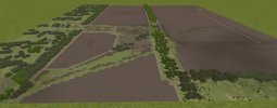
Hi all, currently working on first map with a view to a scenario loosely based around Vuhledar current Ukraine conflict. Lots to be decided yet regarding mission type/units etc on what is available in CMBS, am finding the map creation therapeutic though...  (One annoyance a lot of the tress etc are missing when taking a screen grab, much more cover on actual map)
(Location: Lat: 47.773710° Long: 37.271804°) (Map just over one Kilometer square.)
Thanks for reading (hope this is appropriate to post here).

(Location: Lat: 47.773710° Long: 37.271804°) (Map just over one Kilometer square.)
Thanks for reading (hope this is appropriate to post here).

